|
|
|
 |
|
Meridian Mapping provides a broad spectrum of custom mapping solutions including: Color imagery, GIS Software and Data (Geographic Information Systems), posters, murals and prints, software, custom oblique imagery, training, or a custom solution to fit your particular need.
|
|
Leica Geosystems
Leica Geosystems' photogrammetry products include some of the most sophisticated software tools in the industry, notably Image Analysis™ and Stereo Analyst™ both of which work in conjunction with the ESRI ArcGIS platform.
|
|
 |
|
Safe Software
Meridian Mapping is the Midwestern provider of Safe Software's FME engine. The software makes it easy to get vector GIS, CAD, and attribute data into a form best suited to your needs. The power of FME's core technology lies not only in its ability to break the format barrier, but also in its ability to perform a data model conversion at the same time. The end result? Increases in the productivity of our clients.
|
|

|
|
|
|
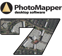
Real-time, accelerated viewing of seamless aerial photography. View vast areas of imagery and associated data overlays - simultaneously!
|